
Searching Multnomah County Property Records
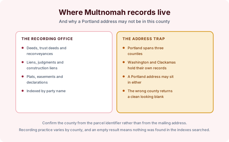
Multnomah County holds most of Portland, and the word most is doing real work in that sentence. The city spills across county lines, so a Portland mailing address does not tell you which recording office holds the deed. Search the wrong one and you get nothing back, which looks exactly like a clean report.
That is the first thing to settle. The second is that Oregon runs a statewide land use system with no real parallel elsewhere, and it leaves traces in the record that an out of state searcher will not recognize.
Confirm the county before anything else
Portland extends into Washington County to the west and Clackamas County to the south, and both keep their own land records. A parcel with a Portland address may be recorded in either. The way to settle it is the parcel identifier or the assessor's map reference rather than the mail, and it takes a minute at the start of a search instead of a wasted day in the middle of one.
Once the county is established, the recording office behaves conventionally. Deeds, trust deeds and reconveyances, liens, judgments, construction liens, plats, easements and declarations, all indexed by party name. Oregon uses a deed of trust rather than a mortgage for most financing, with a trustee holding title for the lender until the debt is satisfied.
Construction liens deserve a specific mention, because Oregon calls them that rather than mechanic's liens and the deadlines run on the state's own schedule. A searcher looking for a mechanic's lien index in an Oregon county is looking for the wrong name.
Oregon does not publish sale prices
Like Texas, Oregon is a non-disclosure state. The consideration recited in a deed is frequently nominal, and the assessor's value is an opinion for taxation rather than evidence of what anyone paid. A buyer expecting the record to show the last sale price will not find it there.
The land use system leaves recorded traces
Oregon has planned land use at the state level since the 1970s, with every city required to maintain an urban growth boundary and rural land protected for farm and forest use. The system is administrative rather than recorded, so most of it sits with planning departments rather than with the recorder.
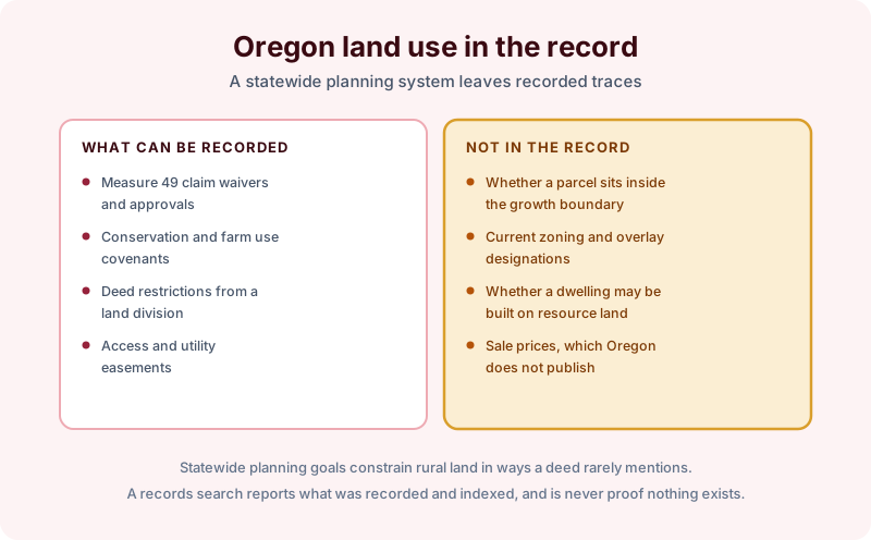
Some of it does reach the land record. Claims, waivers and approvals arising from the ballot measures that modified the system in the 2000s were recorded against affected properties, and they can still appear in a chain. So can farm use and conservation covenants, and deed restrictions imposed as a condition of a land division.
The practical effect on a rural parcel is severe. Farm and forest zoning can prevent a house being built on land that looks entirely buildable, and the restriction comes from the state system rather than from anything the seller did. Buyers of acreage near Portland are the group most often caught by it.
What the record will not tell you is whether a parcel sits inside or outside the growth boundary, what its current zoning and overlays are, or whether a dwelling may lawfully be built on resource land. Those are planning questions, and on rural Multnomah County parcels they matter more to value than anything in the deed.
Ordering a Multnomah County search
Supply the street address, the parcel or account number, and the current owner name, and say if you are unsure which county the property sits in, because establishing that is part of the work rather than an assumption. For rural parcels, say what you intend to do with the land, since that shapes which questions are worth asking of the planning department alongside the search.
A search documents what has been recorded and indexed as of the date it is performed, in the offices searched. Recording practice varies from one Oregon county to the next, and a clean result means nothing was found rather than that nothing exists.