
Searching Anchorage Property Records
Anchorage holds roughly two fifths of Alaska's population on a strip of land between the Chugach Mountains and Cook Inlet. Searching property records there starts with a fact that catches most researchers out, which is that Alaska has no counties and therefore no county recorder.
Three features of Alaska practice decide what a search can reach, and the first one reshapes the whole question.
Recording runs through state districts, not counties
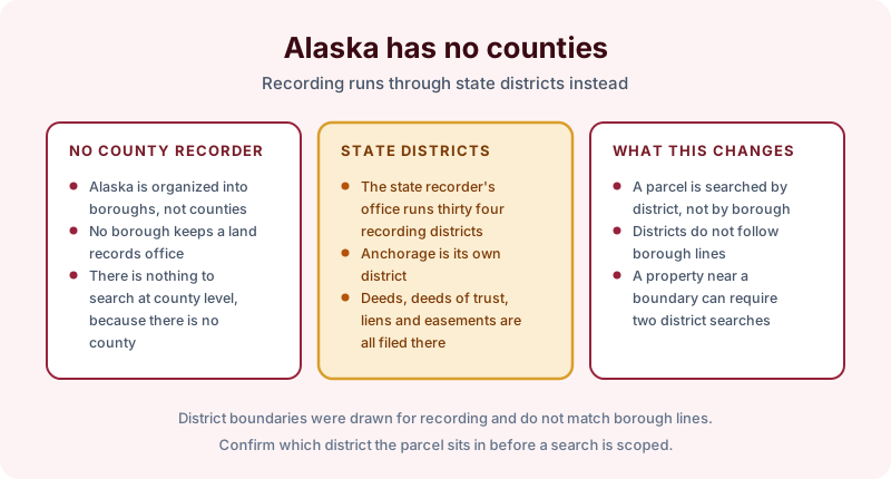
Alaska is organized into boroughs and a large unorganized borough, and no borough maintains a land records office. Recording is a state function, administered by the Recorder's Office within the Department of Natural Resources, which divides the state into recording districts. Anchorage is served by its own district.
Deeds, deeds of trust, liens, easements, plats and assignments are all filed with the district. The practical consequence is that a parcel is searched by recording district rather than by borough, and because district boundaries were drawn for recording rather than for governance, they do not follow borough lines. A property near a boundary can require a search in more than one district, which is the kind of thing worth settling before a search is scoped rather than after.
Alaska is a deed of trust state in practice, so what secures most residential lending is a deed of trust with a power of sale rather than a mortgage, and non-judicial foreclosure is the common route. A chain here will show trustee's deeds and notices of default rather than the foreclosure judgments a judicial state produces.
The municipality holds the parcel side
The Municipality of Anchorage is a unified home rule municipality, combining what elsewhere would be city and borough functions. It maintains the assessment roll, assigns parcel numbers, levies property tax, and keeps the zoning, platting and building files.
That split is the one to plan around. Ownership as the municipality has it is a bridge into the index and nothing more, because the roll reflects assessment records rather than recorded title and can lag a conveyance. Special assessment district charges, which fund road and utility improvements across much of the bowl and the hillside, are administered by the municipality as well, and an unpaid balance can attach to the parcel without anything being recorded in the district.
Platting history is worth pulling here for a specific reason. A good deal of Anchorage was subdivided in bursts, after the 1964 earthquake and again during the pipeline years, and the plats from those periods carry setback notes, utility reservations and in places slope stability restrictions that no later deed repeats. Reading the plat alongside the chain is frequently the only way those surface at all.
Federal and state interests sit alongside the chain
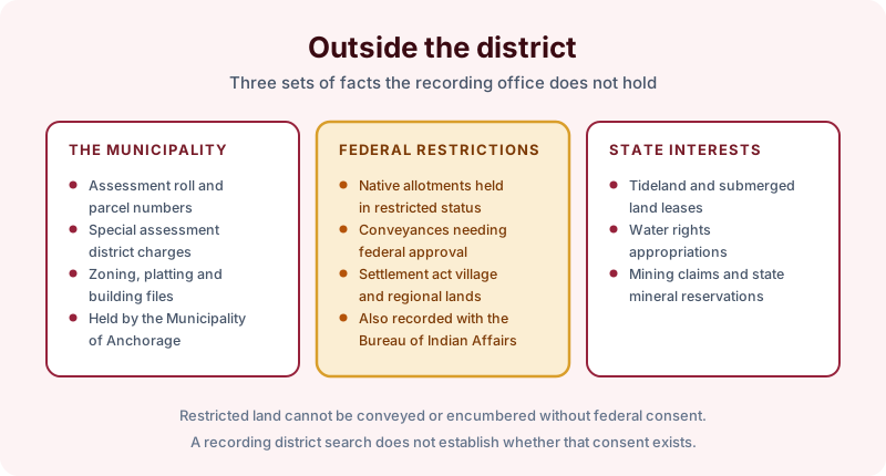
Two categories deserve specific attention. Native allotments conveyed under the Alaska Native Allotment Act are frequently held in restricted status, meaning they cannot be conveyed or encumbered without federal approval, and the restriction is administered by the Bureau of Indian Affairs rather than by the recording district. Village and regional corporation lands conveyed under the Alaska Native Claims Settlement Act carry their own conveyance history, often running through federal patents.
The state is the other party in the margins. Alaska holds title to tidelands and submerged lands, so waterfront use is commonly held under a state lease. Water rights are appropriated through the state rather than described in a deed, and mining claims and state mineral reservations appear in a chain without being searchable in the ordinary index.
What an Anchorage search covers
A recording district search reports the chain of title, the deeds of trust and assignments, the liens, judgments and lis pendens, and the easements, covenants and plats found of record for the parcel over the term searched, with copies of the instruments. It does not establish whether a federal restriction has been lifted, does not reach the municipal assessment or building file, and does not report state water or tideland interests. Nothing found of record is not proof a parcel is unencumbered, and recording and indexing practice varies by district.